Ride Stats:
Distance: 74.27 miles
Average Speed: 11.1 mph
Max Speed: 44.0 mph
Time: 6:41’26
Riding out from Genoa through the rural valley homes was completely different than the last couple of desert mornings. Deer ran through yards, ground squirrels chased each other on driveways, and nervous quail waited for awkward moments to sprint across the street.
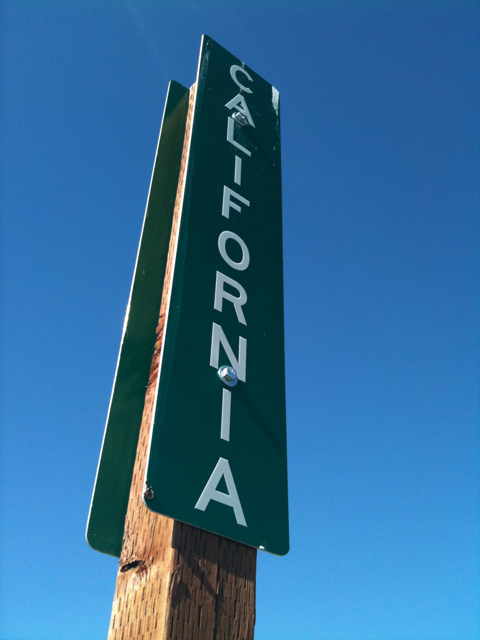
Just a few miles down the road there was fresh black asphalt and a white line cutting the path. A small post read “CALIFORNIA”. The final stretch had been reached. Florida, Alabama, Mississippi, Tennessee, Kentucky, Illinois, Missouri, Kansas, Colorado, Utah, and Nevada had been conquered. No flashy imagery, no motto, no greetings or welcomes, the subtle and excessively simple California sign was probably the best way to greet the unknown.
Today’s ride was to be the final mountain passes. The Sierra Nevadas would put an end to the mountains on my journey. Kit Carson pass was a climb full of steep sections with little shoulder. Heavy truck traffic made most of the way extremely treacherous. I felt like I was in the Rockies again.
There was a ranger station with tourist information at the summit. This would be the last time I’d see my Western Express Section 1 map. I later noticed it missing and would be forced to go on without it. Just like the day that ended in Fallon where I lost the upper part of my flag pole with the flag I had rescued from that wooded road in north Florida. Backtracking just a few feet I like going against nature in a ride like this, especially when it’s back up a mountain that has taken a whole day to climb.
Carson Pass had a smaller summit after it called Carson Spur and a third and final summit that remained unnamed. I was tired going up the third summit, stopping frequently for water. This is where I noticed I no longer was in possession of the map. A motorist named Dan stopped ahead and offered me some Clif bars and blocks. He had been riding earlier and knew what it felt like to face these climbs without energy.
When I finally made it to the summit, I found Mikey changing his rear tire which had worn out down to the carcass. The upcoming downhill made riding a worn tire very dangerous. I chose to stick it out with mine and took pictures of his map while he changed the tire.
It was late in the day and what was supposed to be all downhill turned out to be a series up fast downs with a speed killing climb. The west side of the mountain was not cooperating. Cook’s Station was on the map as a restaurant and possible campsite along the decent but we found that business hours ended at 3 pm during the week. It was getting dark and town was still over 30 miles away. We kept riding down and found Black Station Inn and Restaurant. This old place was not listed by Adventure cycling but had exactly what we needed: a place to stay and food.
Thanks to Judith R. for donating to the ride.


I’m amazed that you’re finding patches of snow this time of year. I’ts supposed to reach 110F today.
The Sierras had almost double the amount of snow this year that they normally have, appx 56 ft (what I’ve heard). This is true in most of the country and explains why so many rivers are flooding.
But another thing is that the summits of these mountains are COLD. It can be 100 degrees in the valley and 50 at the top.