Feeds:
Posts
Comments

Archive for May, 2011

Day 16


Ride Stats:
Distance: 70.06 miles
Average Speed: 12.3 mph
Max Speed: 32.9 mph
Time: 5:39’47

Thanks to Pablo R. for his donation to the ride.

All the birthday wishes were much appreciated. Today was exceptionally uneventful. I decided to go westbound to Corinth, MS instead of continuing north to Tennessee because of a lack of a satisfactory destination within my desired mileage.

This vacation-of-a-post is for my birthday+memorial day. Expect the usual, fully descriptive post tomorrow.

20110531-105443.jpg

20110531-105509.jpg

20110531-105548.jpg

20110531-105633.jpg

20110531-105708.jpg

Read Full Post »

Day 15


Ride Stats:
Distance: 65.83 miles
Average Speed: 14.9 mph
Max Speed: 32.0 mph
Time: 4:24’17

After breakfast and checking out, the morning motel clerk handed me a note. The evening clerk from the day before, Seth, had left me a note wishing me well and suggesting I pass by the Grand Canyon. I have not peeked that far into the maps but I hope that the route goes that way.

The town after Columbus, MS was West Point but I decided to head straight north to make up some time. The road to Aberdeen was flat and fast. A man at a gas station somewhere in between the two towns said what I was doing inspired him. He was headed to enjoy his Memorial Day with some cold, frosty brews.

I made a jump onto highway 25 north before getting to Aberdeen towards Amory. All over the south, they have Hunt Brothers Pizza at gas stations. I grabbed a “hunk of pizza” at a Chevron in Amory and cooled down with a Powerade White Cherry (which tastes like Capri Sun).

A few miles north of Amory I expected to run into Smithville. What I discovered was instead the ugliest thing I’ve ever seen. Smithville is not a town. Smithville is dead. These people were struck by a major tornado in April that decimated nearly every building in the area. There are roads and cul-de-sacs that snake around rubble and foundations. Neighborhoods are mounds. Trees are uprooted. People’s possessions litter the shoulders of the main street. The few buildings that still stand are uninhabitable. The only structures that are still usable are at the north end of the town and a few that were far from the epicenter of the tornado’s path. I was unable to roll through there. I stopped every few hundred feet to take a photo or to see the remnants of of what everyday life must have been in this town. My initial thought was to ask one of the workers of the cleanup crew if this town was going to e rebuilt or if the residents would have to relocate but I decided against it. Neither answer would be able to get rid of the sick feeling I had. I hope my account and pictures of the destruction spark your curiosity enough to research and learn about Smithville, MS. There is a lot of history in that old place that will probably disappear after what has happened.

16 miles worth of mildly occupied roads lay between what was left of Smithville and Fulton. Two more incidents with dogs have really put a sour note in the way I feel owners with aggressive dogs should be judged. If not for the innocent passer-by, then for the dog, PLEASE lock them up. I will sill leave retaliation with pepper spray or a boot to the face as a last resort since I don’t believe it is the dog’s fault, but I would not be surprised if one of those dogs will end up as roadkill. As soon as they get tired of trying to run me down the turn and chase the nearest car.

I reached Fulton in the late afternoon and went into McDonald’s for a vegan BigMac. My reception there was surprisingly upbeat. Employees and customers were curiously interrogating me and I was even able to show them portions of the route on the map.

I have completed the Underground Railroad Section 1 map from Mobile, AL to Fulton, MS. I will only be using a portion of Section 2 since it goes from Fulton all the way to Owensboro, KY. There is a chance that I will make it to Tennessee by the end of the day tomorrow.

20110530-090431.jpg

20110530-090501.jpg

20110530-090541.jpg

20110530-090611.jpg

20110530-090643.jpg

20110530-090706.jpg

20110530-090732.jpg

20110530-090753.jpg

20110530-090818.jpg

20110530-090856.jpg

20110530-090916.jpg

20110530-090946.jpg

20110530-091009.jpg

20110530-091038.jpg

20110530-091116.jpg

Read Full Post »

Day 14


Ride Stats:
Distance: 106.14 miles
Average Speed: 14.1 mph
Max Speed: 37.8 mph
Time: 7:29’22

End of week 2.

Thanks to Tri@ Products, Maria Z., and Yamile C. for their donations to my ride.

Park Ranger Charles unlocked the gates of Chickasaw park as I was gathering my things to start. The morning was extra chilly compared to last night’s sauna session in the tent. The insects were subdued by the lower temperature and the misty air kept the sun to a minimum. Breakfast was a Lucky Charms cereal bar that left me wanting more. The town of Demopolis had a McDonald’s that produced some tasty hot cakes. It was a pleasant morning until they tried to charge me for a cup of water after paying for a whole meal.

I once again went away from the designated route and shot straight for Aliceville. I made few stops and spoke to few people today. One exception was Damon at a BP. He was interested in the ride and was even kind enough to offer a place to stay when I reached Colorado.

Aliceville was a nice town with some old industry buildings and the most American Flags perched on residences and businesses that I’ve ever seen. I stopped at a Subway but wasn’t able to down the whole sub. It was too early and I had too much energy to end the day there. The Alabama/Mississippi border was just a few more miles down the road so I decided to go for it.

Before crossing over to the neighboring state I made a stop at Pickensville. There was a sign for a visitor’s center for a Lock and Dam. I took a detour to nab a photo opportunity but was disappointed when I found that the place was closed on Sundays. I was able to get a distant shot but it is nothing to gawk at. Soon enough, I was in Mississippi.

The amount of hills seems to be diminishing. Upon entering the Columbus, MS area I was able to maintain a good pace because of the flatter roads. I made my way past the local University into town to a motel. Laundry night.

Tomorrow’s goal is to finish the Underground Railroad Section 1 map by making it to Fulton, MS.

20110529-110451.jpg

20110529-110006.jpg

20110529-110649.jpg

20110529-110719.jpg

20110529-110849.jpg

20110529-110754.jpg

20110529-111052.jpg

20110529-111118.jpg

20110529-111214.jpg

20110529-111253.jpg

20110529-111410.jpg

20110529-111625.jpg

20110529-111728.jpg

20110529-112308.jpg

Read Full Post »

Day 13


Ride stats:
Distance: 57.28 miles
Average Speed: 14.3 mph
Max Speed: 38.2 mph

First off, I’d like to touch on a couple of things I have overlooked. On one of those back roads headed to Pensacola I found a small American flag in the grass. Ol’ Glory now adorns my mast and the orange safety flag was retired. When I was in the bike shop in Daphne I purchased a 700x28c (skinner than the 35’s I have on now) tire to have as a spare. The rear tire shows signs or significant wear and this is just s safety precaution. I have included a shot of both so you can see how they adorn the bike.

This morning started at a good pace. Grove Hill was, of course, atop a hill so I rode that down for some time. I had breakfast at a gas station where they were selling puppies and had a big daddy long legs. The photo of it includes a pair of sunglasses for size comparison. I was making good time since I was skipping the road to Jackson and Coffeeville so that I could make it to Linden with less mileage. At one point US-43 became highway 5 and I did not notice. A stop at another gas station came just in time. James, or Jimmy as he introduced himself, asked me about my trip and checked out the blog. His wife recognized the Mason building I has taken a picture of in Perdue Hill. She said that her mother used to dance there when she was a child. I found that to be a nice coincidence, especially after learning that I had accidentally gotten off my intended course. They offered me ice and an atlas, but due to size and weight issues on the Raleigh, I had to turn them down. What I did take with me was a picture of their orange kitten. It was playful and curious, but had neither a name nor a tail.

I made my way back onto the intended highway towards Linden and set out to complete that early so that I could make up some hours of sleep and get back to waking up early.

5 miles north of Linden is the home of Chickasaw State Park. I rode in just as a few people were leaving. The park has RV sections with running water and electricity but no actual showers so I had to rinse off at floor level. The park ranger arrived in a pickup truck just now as I was writing the blog post for the day. The tent is up and the bike is unloaded. At this point I’m just waiting for him to return with the receipt so that I can pass out.

Oh, about the park. It is real small and empty. I am the only one here tonight. The ranger told me that a Canadian couple spent the night here yesterday. They too were riding bicycles. He also told me about a seasonal locust-type insect that is currently active (what a surprise, insects on my trip). They are about 1.5 inches long, .5 inches wide, have black bodies with semi-transparent orange wings and bright eyes. They make a horrid screeching noise with their wings but he assured me that they were harmless.

Tomorrow I plan on making it to either a camp in Cochrane, AL or a motel in Aliceville if I can muster up a few extra miles. That should be my final night in Alabama. I will then cross the western border into Mississippi.

EDIT: The bugs I mentioned are the Periodical Cicadas of Brood XIX. They swarm around once every 13 years. I’ve got great timing, don’t I?

20110528-070732.jpg

20110528-070806.jpg

20110528-071117.jpg

20110528-071211.jpg

20110528-071323.jpg

20110528-071354.jpg

20110528-071447.jpg

20110528-071533.jpg

20110528-071605.jpg

20110528-071638.jpg

20110528-071722.jpg

20110528-071755.jpg

Read Full Post »

Day 12


I think I crossed the 1000 mile mark sometime today.

Ride stats:
Distance: 84.02 miles
Average Speed: 12.4 mph
Max Speed: 35.9 mph
Time: 6:45’38

Late start coming out of Bay Minette, AL. I wanted a bit more sleep. The elevation changes started back up and did not end. I’ve become more used to riding through constant climbs. All of the towns today were tiny. There was nothing more than homes in between acres of wooded areas.

I had a chat with a gas station owner who told me he has seen many bike tourers come through over the years. He gave me some directions that took me through more miles of the saaaame scenery.

I was chased by 3 sets of dogs today. Dammit people, if you have dogs with anger issues keep them on your property! The first was a cat-sized dog that had crazy endurance. It was a bit fun having it follow me for a good distance. The next chase was a pair of fat labs. These guys didn’t have the heart of the first one so their chase was short lived. The third set was a pack of mid sized dogs. None of them were as terrifying as the Rottweiler back in Live Oak, FL. I had my pepper spray ready in case any of them became dangerous.

One of the most difficult climbs was approaching Perdue Hill. A lady at the Chevron there handed me an informative pamphlet concerning two of the oldest buildings in town. Both of them are almost 200 years old. You can see them in today’s pictures. The larger one was a Mason’s Lodge and the smaller one is the William Barret Travis house. Travis was the commander of the Alamo and had a home here in Alabama.

I made it to Grove Hill, AL today and decided not to pass through Jackson, AL. I was told by the lady at the Chevron that Jackson would add an unnecessary amount of miles in the the wrong direction.

I made it to Grove Hill and had a filling burger at a local fast food restaurant. I plan on taking a shortcut to Linden, AL tomorrow.

20110527-113720.jpg

20110527-114026.jpg

20110527-114215.jpg

20110527-114530.jpg

20110527-114312.jpg

20110527-114914.jpg

20110527-115056.jpg

20110527-115816.jpg

20110528-120432.jpg

20110528-120536.jpg

20110528-120557.jpg

20110528-120624.jpg

20110528-120646.jpg

Read Full Post »

Day 11


Ride stats:
Distance: 72.51 miles
Average Speed: 13.0 mph
Max Speed: 36.3 mph
Time: 5:33’30

Thanks to Silvia R. for her donation (rain did not let me turn it into dinner. I’ll shoot for breakfast).

GOODBYE FLORIDA. I am done with the sunshine state. 10.5 days worth of hot sun, unexpected climbs, loose dogs, lovebugs, and a host of encounters with some of the kindest people I’ve ever met.

I wanted to trim a few miles off of the route so I stayed on US-90 westbound. Early into my ride through Pensacola I noticed a store that offered alterations. This was just in time since one of my Giro gloves had started coming apart at the seams. The folks at Rose Nguyen quickly repaired my glove and instead of charging me for it they simply asked that I say “hello” to San Francisco for them. Thanks, I will relay the message!

Highway 90 is not too scenic near the Florabama border but I still had to take some snapshots. HELLO ALABAMA. The sky had been brewing up some showers so I dressed the panniers and saddle with the rain gear. A few miles into the great state of Alabama I was stopped by a curious motorist. Jeff asked me about my ride because he was interested in doing a ride across the Dakotas himself. I strongly suggested he go for it and sent him off with a few tips.

I finished with the Southern Tier Section 6 map at Daphne, AL. This would be as far west as I had to go for now. Frank C. donated a RoadID wristband and had OT shipped over to Eastern Shore Cycles. This was a piece of equipment that i overlooked when planning the ride. If there is an emergency during the trip, police or hospital personnel will be able to quickly identify me and have access to my emergency contact info (I’ll add this to the Gear page soon). When I arrived, I was quickly presented with my new RoadID and had my bike checked out. The guys at the shop were very attentive and even helped me select a spare tire to take along with me. I stocked up on sone nutritional goods and headed north towards Bay Minette, AL.

The rain was approaching from the south at this point so it was a race against mother nature.I made it into town just in time. The clerk at the Log Cabin Inn was nice enough to throw some of my dirty clothes into the laundry.

Tomorrow’s goal is to reach Grove Hill, AL. If my legs and the weather permit I may also make it up to Jackson for some extra mileage.

20110526-100540.jpg

20110526-100717.jpg

20110526-100648.jpg

20110526-100739.jpg

20110526-100840.jpg

20110526-100809.jpg

20110526-100910.jpg

20110526-101026.jpg

20110526-100950.jpg

Read Full Post »

Day 10


Ride stats:
Distance: 92.26 miles
Average Speed: 13.7 mph
Max Speed: 33.5 mph
Time: 6:43’10

At the end of Day 1, I had a phone interview with BeachedMiami.com for a podcast. I would now like to modify a statement that I made. “Riding 75 miles every day isn’t TOO much for someone who rides bike a lot”. What I SHOULD have said was “Riding a ROAD BIKE for 75 miles every day isn’t TOO bad for someone who rides bike a lot… But riding a FULLY LOADED TOURING BIKE through variable terrain, raw sun, and unfavorable winds while constantly having to stop to navigate and refuel by yourself every day is very difficult”. Who was I kidding?

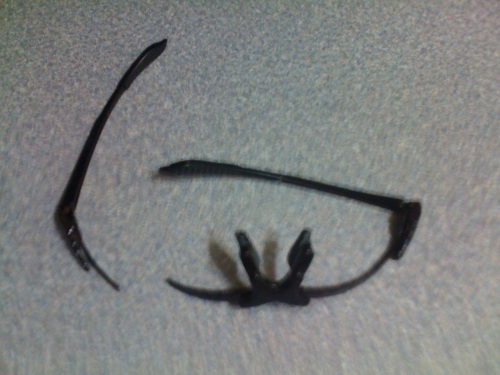
This morning started on a sour note. My sunglasses effortlessly broke in half when I was ready to start.

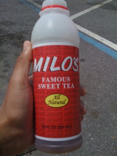
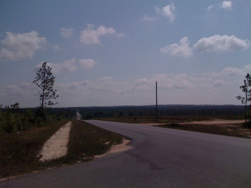
Leaving DeFuniak Springs was bland. The road looked just like the one heading into town. A Dollar General provided me with access to a Lunchables and some Milo’s Tea. I’m a preacher for rising WITHOUT headphones but today’s ride wasn’t cutting it. I tossed them on and immediately upped my speed. Today’s average speed was over 14mph for most of the day and ended at what I think is one of the higher averages in the last few days. I had one of the best tasting convenience store cookies ever at a Tom Thumb in Crestview.

US-90 was the route for most of the day. Adventure Cycling kicks you off of 90 when you get to the town of Holt and sends you through some back roads. Thanks for nothing guys. My speed dropped and I had to overnavigate an area that has no real pit stops just as an excuse to hit a 7 mile bike path that leads to Milton.if there is ever a next time, I’ll stick to 90.

Milton had an Arby’s where I refilled my bottles with ice and water. Pace was nothing more than a CVS stop. The road into Pensacola reintroduced me to hilly terrain. I hadn’t quite escaped them but they had been few and far in between all day. Pensacola is like a mild version of Tallahassee when it comes to climbs. I ended the day there and stopped at a Days Inn.

The weather report for tomorrow looked like rain and lightning so there is a chance that I may not leave for Alabama in the morning.

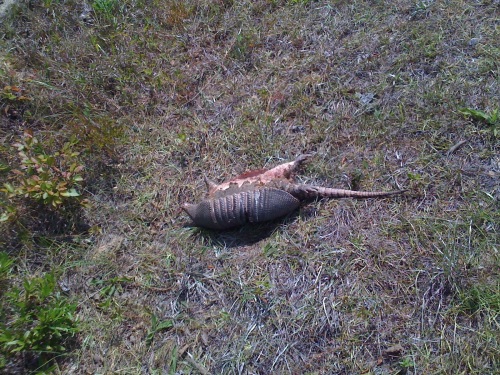
In an effort to log what I have encountered in this ride, without being too morbid, I have included a shot of one of the cleanest roadkill armadillos that I have come across. There have been plenty of animals that have ended with Goodyear printed on their faces along my way but ‘dillos have been the most common.

I’d like to thank Kenny H., Jennifer H., Marcus W., and John V. for their donations. All you caring people are making this rough ride much more bearable.

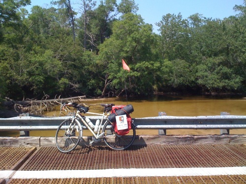
I didn’t stop for too many pictures today. There wasn’t much to capture and I didn’t want to take my brisk speed for granted.

20110525-111856.jpg

20110525-112021.jpg

20110525-111941.jpg

20110525-112052.jpg

20110525-112308.jpg

Read Full Post »

Day 9


Ride stats:
Distance: 83.43 miles
Average Speed: 12.5 mph
Max Speed: 30.6 mph
Time: 6:40’21

I had some corn and a beer with my fellow campers after last night’s blog post. They told me that they were in Sneads working on upgrading the dam at Lake Seminole. I would have liked to stay up and chat a little while longer but my sleep time is limited.

Sleeping in the tent was a challenge. A few bugs had made their way in and wanted to cuddle. I was able to clear some of them out of the tent including one mosquito that had just finished having a full serving of my blood (check the photo).

An early start this morning by the foggy lake was a nice change of pace. I was no longer facing the hilly terrain of the past few days, rather, flat strips with only occasional climbs. I stopped over at Grand Ridge, the neighboring town, for a heaping homestyle breakfast. Only 20 miles into the ride, I stopped at a CVS in Marianna. It seems I’ve gotten comfortable with sleeping in public after an hour long nap on the shady side of the building.

That midday break brought back enough energy to go through the rest of the day. A stop in Cottondale to refuel and charge my phone met me up with a lottery representative who wished me well and a store owner who lent me a power outlet.

Somewhere along highway 90 there was a car that had just pulled over. I stopped after being waved down. Bob and Linda introduced themselves as being from Bonifay. They said that Rey had seen me at a convenience store in Tallahassee. Their brief company in what would have been another long lonely road was welcome.

The Southern Tier Section 7 map is now complete. St. Augustine to DeFuniak Springs. This town revolves around a strangely round lake. I’m in the south section now and have restocked some supplies at a nearby Walmart.

Tomorrow’s destination is Pensacola. That is the final destination in Florida.

Thanks to Eliana V., Guido P., Brenda G., and Robert I. For for your donations. It’s really kind of you all.

20110524-100559.jpg

20110524-100536.jpg

20110524-100624.jpg

20110524-100706.jpg

20110524-100739.jpg

20110524-100818.jpg

EDIT: ‘dillo skewers. two for a buck

Read Full Post »

Day 8 (Part 2)


Ride stats:
Distance: 54.28 miles
Average Speed: 11.2 mph
Max Speed: 33.7 mph
Time: 4:49’53

I had no idea that Florida had this many hills. These last few days of climbing required an easy day hence my mileage today.

Right after my break in Quincy I stopped to refuel. Darrell Anthony, a customer at the Chevron said that I was crazy for trying this and I should just head back. I was a few hills away from agreeing with him. Chattahoochee had a man who told me that if I was headed to Sneads (my destination for the day) I was “nowhere from Sneads”, just on the other side of the river.

Greetings from Central Standard Time! Crossing the Apalachicola River bought me an extra hour. I called a campground in Sneads and asked for directions. Once at the Seminole Lodge Marina, Motel, and Campground I met the voice on the other end of the line. Monte is the man running this place and he gave me a quick overview of the facilities. The park is right on Lake Seminole and has some of the best bass fishin’ around. I’m kinda bummed that the only Shimano equipment I have with me is for the bike. A cast or two couldn’t hurt.

My tent neighbor Tarzan, as they call him, greeted me and offered a ride into town in case I needed anything. Come to think of it, I could go for a warm meal right now but that’ll have to wait till morning. The tent’s pitched n’ steaked and the chiggers and no-see-ums are out in full force. Tomorrow’s goal is to finish this map by making it to DeFuniak Springs.

20110523-071145.jpg

20110523-071215.jpg

20110523-071247.jpg

20110523-071317.jpg

20110523-071343.jpg

20110523-071415.jpg

Read Full Post »

Day 8


Did a bit of sight seeing in the capital city. Passed by the supreme court and capitol buildings. Roamed FSU and found my way to a hotdog place. All the climbing yesterday is being billed today. Collections came by and took my energy. I’m taking a break now in Quincy on the side of highway 90. The dirt here is a different color by the way.

20110523-021906.jpg

20110523-021936.jpg

20110523-022000.jpg

20110523-022024.jpg

20110523-022051.jpg

20110523-022135.jpg

20110523-022201.jpg

20110523-022238.jpg

20110523-022304.jpg

Read Full Post »

Older Posts »